
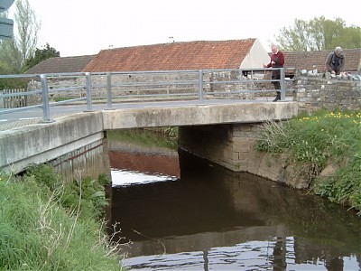
Northload Bridge
|
|
||||
 |
||||
| Bridge Name: | Northload Bridge | |||
| No.: | 12 | |||
| Location: | B3151 Meare Road out of Glastonbury at junction of Dyehouse Lane and Godney Road. | |||
| Build Date: | 20th century | |||
| Engineer: | ||||
|
© Copyright somersetrivers.org |
||||
| Description: | ||||
| Simple concrete beam with metal parapet railings on the upstream side and stone parapets on the downstream side.
North Bridge took Northload Street north-west onto the moor, probably replacing a ford in the medieval period, is marked on the c1609 map1 |
||||
| References: | 1.Somerset Extensive Urban Survey – Glastonbury Archaeological Assessment | |||